From the first time I heard of Granja Porcon, I had no interest in going there. About an hour from Cajamarca, numerous people mentioned it to us as a “must see” tourist site. But when I asked what one did there, all I heard was that it was in the country and had a zoo. In the country? Don’t I live in the country? Roosters wake me up long before dawn, cows graze on the side of the running path, horses frolic along the bank of the river a few blocks from my house, I recognize the burros that carry a farmer’s milk down our street every day…how much more country did I need? As for a zoo, I have mixed feelings about them and was pretty sure a small, private zoo would make me feel less mixed and more distressed. Add to the fact that Granja Porcon is run by Evangelists and had been described as both a commune and a cult and I was not sold.
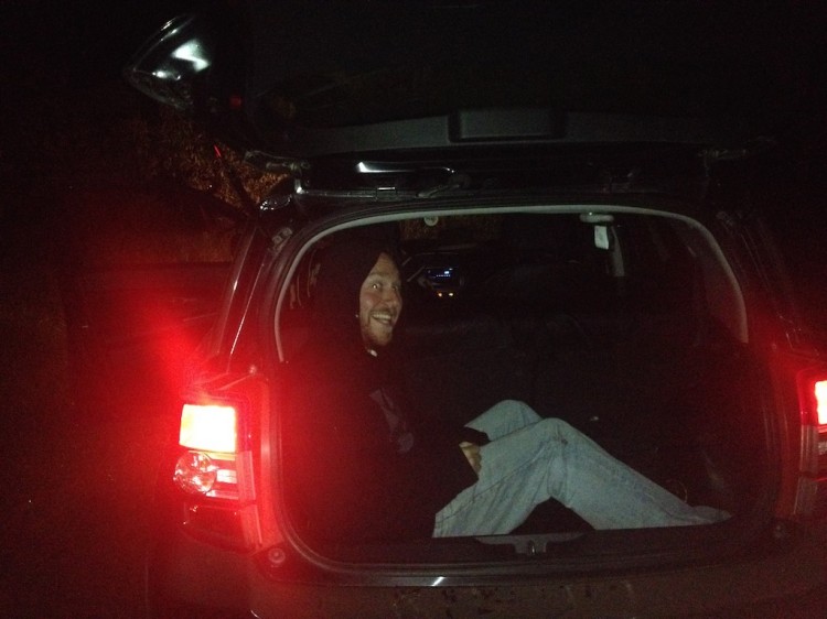
But as our entertainment options are limited, when some friends suggested we go there for the weekend in order to take advantage of the hiking trials, I was persuaded. We set off Friday after work in Korrine’s dad’s car with Rodrigo as our driver. Our first stop was at the grocery store to buy some wine that we intended to “sneak” onto the grounds. To be honest, while alcohol was not served on the premises, I never saw any mention that it wasn’t allowed, but it added to our high school feel for the weekend: dad’s car and smuggled booze.

On the road

Stopping for provisions
The drive out of Cajamarca was pretty and uneventful. After about an hour we arrived at the turnoff to Granja Porcon. Another 25 minutes and we were at the gate, just as the sun was setting. We had reserved a cabin and the guard gave us directions to get there. I tried listening to the directions in order to help navigate, but after he kept describing the roads we were not supposed to take, I gave up. We started up the mountain, darkness descended and we had no idea where we were going. We stopped at one place where we saw lights and the woman there told us to continue up the road. Just as we left, a man ran after us shouting that we should take a left – but left led us back down the mountain. We confirmed that we were supposed to go up the mountain, took a right to do so and then laughed at his “left” direction. 20 minutes later we were not laughing when we could see nothing and were utterly lost. We headed back down the mountain, intending to go back for more directions, when a lady on the side of the road waved us down, introduced herself as Marleny and told us that she had been waiting for us to show us our cabin. The “left” made sense as we had to take a left to go down a small, dark road that led only to the cabin – a left that was only about 5 minutes away from the house where we had asked directions! It was now about 8:00 and there was only one restaurant – back down the mountain – that was open to serve us dinner. We unloaded the car, nervously trying to hide our bottles, called in our dinner order and then began the trek down the mountain. Marleny came with us because she thought we would get lost otherwise. She was right!
The way back
Despite calling ahead by about 1/2 hour, the restaurant was deserted. A man quickly appeared and opened the place up for us. It was a cold, beautiful, rustic room with windows that overlooked the Porcon main square, but at the late hour we could only see a few lights in the distance. We enjoyed a lovely meal of chicken soup and fried trout and headed back up the mountain to our cabin, stopping to pick up a thermos of hot, boiled water from Marleny’s house. A few drinks later we called it a night. It was freezing in the cabin – the only heat was the fireplace in the main room and the beds had those old fashioned wool blankets that weigh you down so you can barely move. Matt and I slept with our hats on and were still cold!
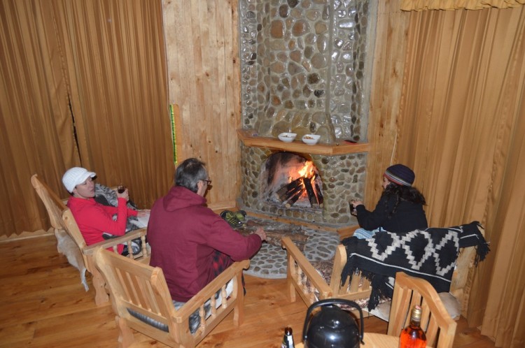
Warming at the hearth
The day dawned overcast, but it was still breathtaking. It felt as though we were on a movie set – gorgeous setting, rustic cabin, cows mooing, lambs bleating and roosters crowing – unreal.

Cabin in the mist

Top o’ the morning!

Gathering wood

Firestarter

Morning mist
We headed back to the restaurant for a breakfast of caldo verde (my favorite soup) with numerous stops along the way to admire the vicuñas and avoid the lambs. Vicuñas are cousins of alpacas and llamas (and guanacos, another wild camelid in the Andes) and are prized for their wool, which can run up to $3,000 a yard! The animals can only be shorn every 3 years and then only about a pound of wool results from each animal. While they are described as shy, the ones at Porcon are obviously accustomed to tourists because we got amazingly close to them. They were gorgeous – so graceful and delicate. The lambs, on the other hand, were just hilarious. They were all over the road and it was all Rodrigo could do not to hit any of them. The downside of all the lambs was that meant there was no sheep cheese for sale – something I was really looking forward to as I am so tired of the limited cheese selection here.

Lambsies

Baaaaa

Little lambs eat ivy…

Shady lane and vicuñas

Vicuñas and view

Chillin’

Vicuña and incan corn

So close to these beauties!
Once we tore ourselves away from the vicuñas, I then became fascinated by a hummingbird feeding outside of the window at the restaurant. It was quite a dramatic scene when another hummingbird appeared and they began fighting. In addition the view was breathtaking.

In for the landing

Hovering

In flight

Resting

Eating

Ready for takeoff

Fluttering
Fight!

Lone vicuña

Watching the vicuñas

Incan corn

Local

Porcon mushrooms
After breakfast, we wandered into the town to check out the weaving shops, dairy and zoo.

Colorful wares for sale

Vibrant colors

Natural dyes

Loom

View from above

Wool drying

Proprietess weaver

Men in hats
I found the dairy products to be disappointing – while there were some decent fresh cheeses with herbs and a brick that was sharper than anything else here, nothing came close to amazing Carr Valley or other Wisconsin-produced cheeses. The others were hyping the ice cream and I, lover of Kopps frozen custard, couldn’t wait. What a letdown! The so-called “ice cream” was really ice-milk on a stick and not at all creamy. There were many exotic fruit flavors, but that was little consolation for me. After that crushing disappointment, we headed to the zoo.
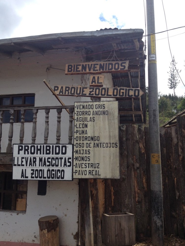
Zoo sign
The zoo was interesting. One the one hand, the old-fashioned, small enclosures were incredibly depressing. But all zoo enclosures are depressing – no matter how big the enclosure, the lions and tigers still pace in captivity, the birds can’t fly free and many animals are far from their natural habitats. On the other hand, it was unbelievable how close we could get to the animals. As I was watching the spectacled bears, native to Peru, walk along the fence, a little girl stuck her finger into the enclosure and I started panicking, wondering if it is socially acceptable for a stranger to yell at a kid when you think she might lose a finger (and then, to try to think of how to say it in Spanish!). Thankfully, her mother saw her in the seconds these thoughts raced through my brain and pulled her away. Yikes!

Monkey

Jaguar

Primate getting away from it all

American Male

Primate

Spectacled bear

Paddington’s cousin?

Bottom up view of the zoo

Our pals

Bird houses
After the zoo and a mediocre meal in town, we headed back up the mountain to our paradise. Marleny, who was parking cars in town, tried to persuade us to stop at the trout farm or come back to see the 4 o’clock milking, but as neither of those things are novelties to us, we declined and relaxed the afternoon and evening away. Well, except for the parts where Rodrigo smoked us out of the house by trying to start the wood stove in the kitchen, not realizing that he had blocked the flue and that we didn’t have the key to the kitchen door so there was no ventilation and then, when Marleny showed up unannounced and we scurried around trying to hide our wine bottles and glasses!

Serenity

Road to the cabin

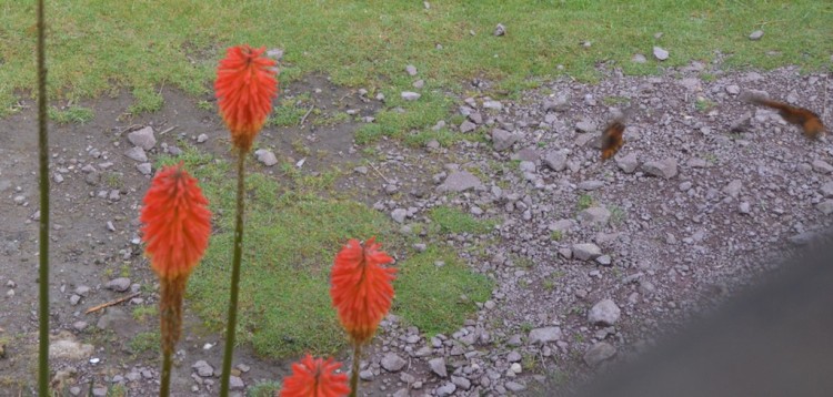
Floral beauty

Staying warm native style

Afternoon view

Little house on the mountain
We were all in bed by 10 pm, but that allowed Rodrigo, Matt and me to get up early and climb to the summit of Mt. Porcon the next morning. It was only an hour hike on a dirt path to reach the top and the views were amazing. After all my reluctance to go, I completely fell for Porcon and would love to go back to do more hiking. It was peaceful and picturesque – the perfect getaway weekend.

Top of the mountain

Inca corn

Classic shot

Perfect Christmas tree

Contemplation

Path

Made it!

Wow

Never gets old…

View from the top


")
")
")
")
")
")
")


")