The Lunar Landscape – Uyuni Trip Continued

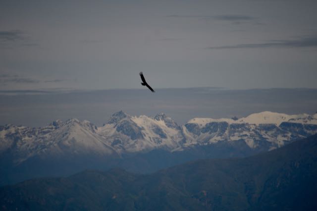
Day 2 began early in the dark and cold. Breakfast was terrible and the hostel workers were hostile, so we were on our way without delay. The theme of the day was rocks and more rocks. The pictures don’t do it justice, but it was magical to drive for an hour or more seeing this:

Sandy Expanse

And then suddenly to see this:

The Rocks Await

The magic of nature! It was fascinating how the elements and time combined to plop down these rock playgrounds at random intervals. We had a blast exploring although the rest of the group was definitely more adventuresome than we were. Climbing is not among my skills.

“And if you go chasing rabbits, and you know you’re going to fall
Tell ’em a hookah-smoking caterpillar has given you the call”

Go Ask Alice was my mental soundtrack often throughout this surreal trip.

This view reminded me of a sand art picture someone had when I was a kid.

Sand Art

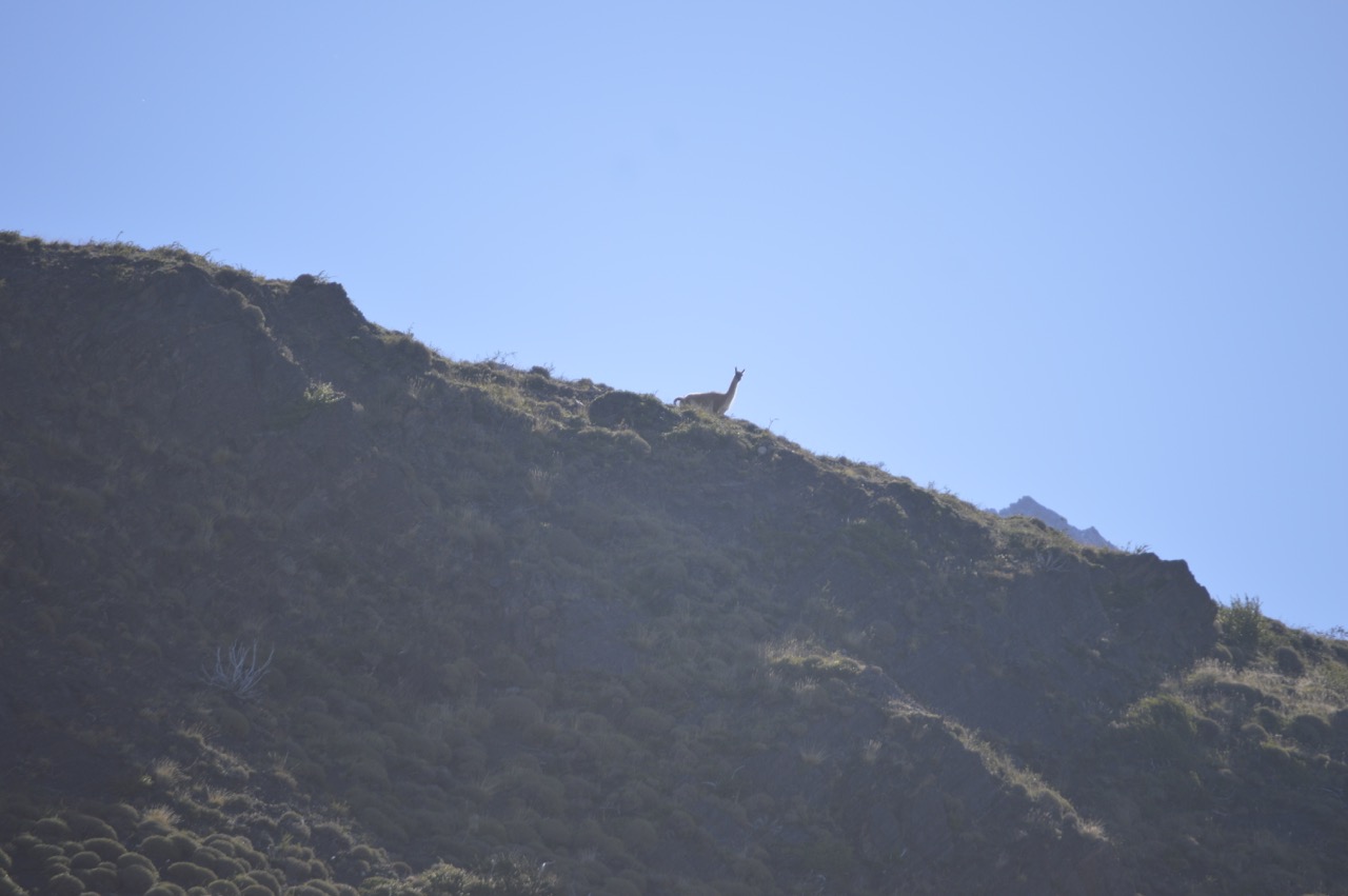
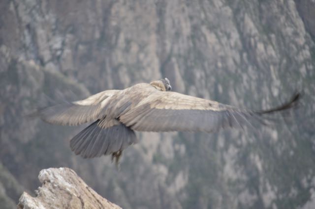
Despite the desolate landscape, we saw some animals on the trip in addition to the flamingos and viscacha.

One challenge of the long drives is the lack of bathrooms or shelter for a “natural” bathroom. We were all desperate on the second day, which wasn’t a big issue for the men but a hardship for us women. At one stop we found some scrubby bushes, but when I saw evidence of prior use, I managed to hold off until we hit a store about 2 minutes from our hotel. Not a moment too soon!
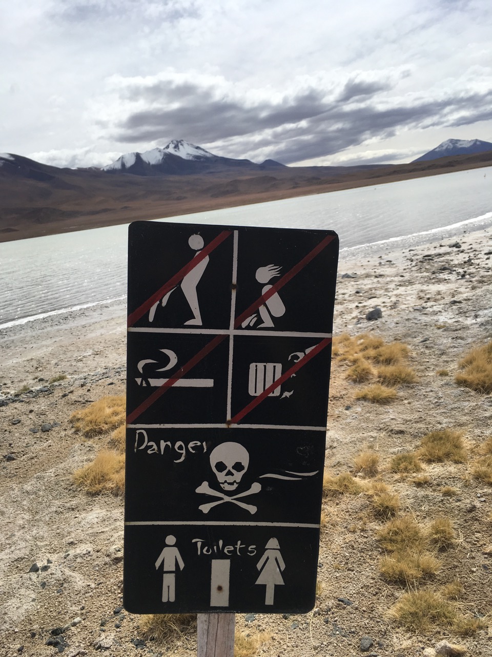
Behave!

We stayed in a salt hostel the second night. The tables, chairs, beds, and interior walls were all made of salt. It was still frigid, but the accommodations were slightly better – we had a private, windowless room – and the workers were friendly.

In order to see the sunrise from Incahuasi Island, we were on the road shortly after 5 a.m. on the third and final day. Of course, there was no road; we were driving in the dark across the salt flats. It was disorienting: I felt as though we weren’t moving because the landscape never changed – the salt flat is over 4,000 square miles! I spent the entire day convinced we were on a frozen lake as opposed to a salt flat. I kept expecting to see some ice shanties and snowmobiles.

The island was amazing. It was the top of a volcano back when the salt flat was covered by a sea. Now it is covered by cacti, but you can still see the coral and other fossils. We got there and hoofed it to the top to get perfect pictures of the sunrise. For some reason, I had a hard time getting to the top, possibly due to the altitude or because I am not a morning person, but I managed to get there in time to see the sunrise along with a crowd of tourists. I tend to find sunrises overrated (don’t get me started on the Grand Canyon sunrise trip!) but this one was spectacular.

Morning has Broken

After breakfast we zoomed across the ice salt to get to the “perfect” spot for our photo shoot. Due to the expanse, the horizon is messed up and the shots are surreal. We played around for a couple of hours. Beatriz and Jorge came well prepared  – shots off the salt flat!

After a fast stop at a salt hotel, which apparently was only open for the Dakar rally, and a small town for trinkets, we were on the outskirts of Uyuni at the Train Graveyard. This is always the part of every trip when Matt and I would call it a day, but the tour operators want to give you your money’s worth even if obviously not everyone welcomed tourists.

Uyuni was a desolate, depressing town. While there was plenty of space because it was surrounded by the salt flat, there was garbage dumped on just about every corner. I couldn’t imagine why anyone would live there if they had a choice. I asked our guide if he lived there and he spoke with pride as to how healthy it was there and how people never get sick because they have a good quality of life. I was stunned, but to each their own. We checked into one of the nicest salt hotels in town (at about $55 a night) and enjoyed the hot shower and comfy beds!

“What a long, strange trip it’s been” sums up the Uyuni salt flat tour perfectly!

Incredible Iguazú Falls!

When I 15, I went to Niagara Falls and was underwhelmed. I don’t know what I was expecting, but I recall thinking the gardens were pretty and feeling cheated by the falls. I was expecting something  majestic and it looked like a big dam. Decades later, Iguazú Falls provided the majesty I was seeking.

Iguazú Falls is on the border between Argentina and Brazil and is described as the “largest waterfall system in the world,” which I learned is because there are various ways to measure waterfalls in order to maintain bragging rights! We wanted to go to both sides of the falls but didn’t have time to get the required Brazilian visa. While I read posts that said sneaking visa-less over the border in a cab was no big deal, we decided not to become an international incident and stayed in Argentina. Compared with many of our adventures, it was pretty easy to get to the falls – we walked into town from our lovely hotel, the Iguazú Jungle Lodge, and caught a bus to the falls. Once there, it reminded us of the Milwaukee County Zoo – walking paths winding through wooded areas, kiosks and concession stands and even a train to take you to the “Devil’s Throat” to see where about 1/2 of the Iguazú river’s volume crashes over the top of the falls. The Devil’s Throat is 80 meters (262 feet) high and 2,700 meters (8,858 feet, 1-3/4 miles!) in diameter. The entry to the falls had an amusement park feel, but soon we were taken by the natural beauty. I had so much fun the first day and we didn’t get to see every corner of the park, so I decided to return the following day. Matt opted to join me and was glad he did as our first day was overcast and the second day sunny, which gave different perspectives. Plus, it had rained considerably overnight so the falls were noticeably fuller the second day.

First stop both days was the Devil’s Throat. Spectacular!

Devil’s Throat Panorama

Thank goodness that I had to get over my grate phobia in El Calafate, because I really had to get over it to enjoy Iguazú Falls!

On the first day, we had bought tickets for a boat ride under the falls. We lingered at the Devil’s Throat and then needed to scurry around the park to find the boat launch. Somehow we missed a turn and arrived 5 minutes before the boat was leaving. Thankfully, we were obviously not the first clueless tourists and the worker provided us tickets for the following excursion. I had been ambivalent about doing the ride, but it was great fun. You cruise down the river and look at the falls and then suddenly the captain guns the engines and drives you smack into one. Despite the ponchos, there is no escaping the deluge of water. I thought the women who brought swimming goggles were brilliant as I feared my contacts were going to get pushed out of my eyes! When you are on the trip, you feel like you are directly under the falls with the amount of water that crashes down on you, so I was surprised when we watched another boat cruise into the falls and saw that they really just go to the perimeter.

I loved that there were so many waterfalls to see – between 150 and 300 depending on the amount of water flow. Each one was pretty in its own way.

The lush jungle setting made it so much more magical than Niagara and allowed us to see capuchin monkeys, toucans and other birds, coati (raccoon-like creatures that will shamelessly try to steal your food) and butterflies. There were boa constrictor warning signs and jaguars in the park, so I watched for those although I couldn’t decide whether I was disappointed or relieved when we didn’t see any!

This slideshow requires JavaScript.

Iguazú Falls is a magical place. It is no wonder that upon seeing it, Eleanor Roosevelt is reported to have said, “Poor Niagara!”


Glaciers Galore!

I’m weeks behind on writing any posts, but anyone who knows me knows that I am all about chronological order. When we left Chilean Patagonia’s Torres del Paine National Park, we crossed the border into Argentina and headed to El Calafate. Still in Patagonia, El Calafate is a cute tourist town capitalizing off the proximity to Glacier National Park. After some pampering and a day of rest in a nice hotel, we were ready to check out some glaciers.

Glacier National Park

Our first tour was to El Perito Moreno glacier. El Perito Moreno’s claim to fame is that it actually is advancing as opposed to retreating like most of the world’s glaciers and every several years it forms a bridge with the land that lasts for a period of time until it crashes into the water. While I was interested in seeing the glacier, I had no idea how wowed I would be. The park has a series of metal walkways (I had to quickly get over my grate phobia) that allow many different views of the massive glacier. It looks like an advancing ice army and its creaking and groaning are spectacular. There was no ice bridge, but we were fortunate to see several calving incidents. Despite the dreary, drizzly day, we had a fantastic time.

The next day was our big adventure: kayaking at the Upsala Glacier. Matt and I are experienced kayakers, but I was still nervous about kayaking near a glacier and in frigid water. What a great time! The tour company, Upsala Kayak Experience, was fantastic. We had excellent gear (although I can’t stand things around my neck and the dry suit was a necessarily tight fit!) and the staff was fun and engaging.

Not everyone had kayaking experience, but after some instructions and paddling demonstrations, we set off. We intended to go to the face of the Upsala Glacier, but a storm blew in and our guides wisely determined a better course was to paddle around a large iceberg.

After we paddled around the iceberg, we headed back to shore. It was strenuous paddling as the wind was against us and the guides worked to keep the group on track. One kayak needed to be towed when they got far afield. Matt kept us on course and we paddled well together, which is unusual! The weather cleared up a little and we were offered the treat of paddling under a waterfall. Matt and I gamely went first and had a ball. I was shocked that we stayed dry. Each kayak had two trips under the falls, then we returned to the boat for the ride back to the dock.

Waterfall

After two active days at the glaciers, we relaxed on our last day and enjoyed walking around town and through its park. We recognized our pal Darwin with a few of his animal friends.

After 10 days enjoying nature, we left El Calafate for Buenos Aires to enjoy some city living for a couple of weeks. Stay tuned!

A Walk, or Few, in the Park

Sunset in the Park

Our South American adventure started in Southern Chile’s Patagonia in the Torres del Paine National Park. It’s not the easiest place to get to – 24 hours of flights from Mexico City to Punta Arenas, Chile, and then 5 hours of bus rides to get to the park and another 40 minute bus ride to our lodge* – but it was well worth the long journey. It may be the most beautiful place I have ever been. Or maybe that was because I was so happy to be in the mountains again after island living for 2 years. Mountains, glaciers and lakes, oh my!

There are two ways to visit the park: backpack and do one of two multi-day hikes – the circuit or W – or stay in a hotel and take day hikes. As my camping limit is generally 2 nights and I don’t carry gear, we opted for a hotel. There are not many in the park, so we chose the most economical and had low expectations based on the reviews. Once again, my life experiences of rustic Wisconsin cottages served me well as Hosteria Pehoe has seen better days.

The point of the park is not the accommodations, but the views. Hosteria Pehoe had the best hotel views in the park, hands down. Our bartender showed us where to take the path to the scenic view for our first sunset, and the sunrise the next morning was equally spectacular. Even better – sunrise was around 8:15 a.m. My kind of place!

This slideshow requires JavaScript.

We were out of hiking shape, but raring to go. On our first day we took a walk on the road to the Salta Chico waterfall and then hiked up to a lookout where we saw soaring condors. It felt great to be back in the mountains.

Day 2 was intended to be our easy day. We were building up to a 12 1/2 mile hike to the base of the Torres that we planned for Thursday, so on Tuesday we arranged to take the boat cruise to Grey Glacier. This is where traveling in a remote place with primitive hospitality services has its drawbacks. The wifi at our lodge wasn’t good enough for us to make the reservation for the cruise. The desk clerk at our lodge assured us that while the cruises were scheduled four times a day, the only one running was at noon and that we would have no problem booking it upon arrival the Hotel Lago Grey, where the boat departs. Unfortunately, she was not willing to make a call to reserve it for us. So we, together with another couple, hired a driver to take us to the Hotel Lago Grey where they informed us that there were no spaces on the noon cruise, but we could get on the 3 pm cruise. As we had 5 hours to kill, our options were to hang around the hotel or to take a hike to a scenic lookout above the lake. Feeling energized by the mountain air, I pushed for the hike.

Early View

The beginning of the hike was pleasant and I was happy with our choice. Then it got steep and I was slogging along. We were hiking with the other couple, and I felt like I was holding everyone back, a feeling I hate. I missed the stability of my hiking poles and regretted pushing for the hike. The other husband bailed while we forged ahead with the wife. Shortly thereafter, a couple of American men overtook us. They were trying to rally me to keep going, but I threw in the towel and Matt elected to descend with me while we sent the other woman off with them.

We cruised back down to the road and then our driver took us to the beginning of the trail for the hike to catch the boat. We trooped across a rocky beach, admired the bobbing icebergs and waited for the Grey III.

What a fun trip! The clouds that had blown in made it all the more interesting when trying to stand on deck in the driving wind. The color of the icebergs was an amazing blue and the glacier was impressive. I was surprised by how close we got to it. I was lucky be on deck to catch a moment of calving – when ice breaks away and falls into the lake. Fantastic!

I was demoralized after my failed hike to the lookout, but the next day we decided to walk to Salto Grande waterfall. Somehow it escaped us that it was an 8 mile walk, which wasn’t exactly our plan for the day before our big hike. But it was another lovely day for a walk.

Finally, the day had come – our hike to the base of the Torres. I was nervous about managing the hike, but I got the lowdown from a family we met who did it the day before us and our driver gave me a pep talk on our way to the start of the trail. We stopped to buy some provisions and then as we prepared to leave, one of my hiking poles was stuck! I was looking at the ridiculously priced gift shop poles, wondering whether it was a sign that I was too out of shape for the hike, when a workman walked by. We asked him for a pliers and he willingly helped us get my pole in order.

This slideshow requires JavaScript.

The hike was hard. It was not as steep as the Grey Lake lookout and we were prepared for hiking, but it was not easy. At least not for us – plenty of people practically skipped by us. The hardest part was the end when you are climbing up boulders, sometimes through shallow streams. But it was spectacular – the terrain changed a lot throughout the hike, you could dip your water bottle into the stream for water and the day was fantastic. I am not sure that I will ever be in a landscape so breathtaking again.

On our last day our driver took us on a half day tour of the rest of the park before catching our bus to Calafate, Argentina. We enjoyed strolling on the shores of the beautiful Lago Azul (Blue Lake), admiring the rainbows in the Paine Waterfall and observing the wildlife. We saw so many guanacos on our days in the park that we felt like we had seen 90% of the entire population. I was keeping my eyes open for a puma, but we never spotted one although we enjoyed seeing many lookout guanacos on the hills standing watch for their herds.

Protector

Another grand trip to remember!

* In retrospect, we should have rented a car instead. Despite reading about a “shuttle” there was no public transportation within the park and we paid a small fortune in private transfers.

The Tourist Trap of Lake Titicaca Part II – Taquile Island

After leaving the Uros Islands with an uncomfortable feeling that we had just been conned (The Tourist Trap of Lake Titicaca – Uros Islands), we settled in for the 2-hour boat ride to Taquile Island and hoped our next experience would feel more authentic. Along the way, our guide told us about Lake Titicaca and Taquile. The people are known for their beautiful textiles and, in an interesting twist, the men all knit and the women weave. Similar to the Uros Islands, the Taquile community decided to control the tourism on their island. The community is a cooperative and runs day tours, home stays, restaurants and textile sales. After lecturing us for awhile, our guide piped down and most of us cat-napped on the ride.

Taquile is tiny – about 3.5 miles long and 1.5 miles wide – and stunning. We landed on a lovely beach with farming terraces dotting the hillside above it. Some young tourists who had done a homestay were playing with local children on the beach when we were met by our local male guides.  They were wearing beautiful outfits – bright, knitted hats with earflaps (chullos) and gorgeous woven sashes (chumpis). The men never stopped knitting. It was remarkable to see them walk and knit, especially given that we were not on smooth pavement. The hats denote marital status. While men wear knitted hats, with or without earflaps, married men wear red, patterned hats folded to the right, while unmarried men wear hats that are red and patterned at the bottom and white at the top. Folded to the right, it means he is looking for a girlfriend; hanging down the back means he is taken or not yet interested in dating. The island’s elected officials (men) wear black, felt hats during their terms. The community marries within itself, and our guide bluntly remarked that a disabled man who was causing some minor disruptions is the end result when the gene pool doesn’t expand. In addition, couples cohabit before getting married. If the cohabitation doesn’t work out and they didn’t have children, they part ways. I’m not sure how that works out as it would be pretty hard to avoid your ex on this tiny island!

After a brief introduction on the beach, we walked up the path. Matt and I thought we were pacing ourselves and going slowly, but apparently we weren’t as we inadvertently ended up following another group and had to be shooed back to wait for our own. Due to the altitude, some folks had a trouble with the ascent, but we had been in the Andes long enough to be acclimated. The views are stupendous and we were able to see Bolivia in the distance.

Eventually our group congregated in a courtyard and the women filed in to set up their weaving. I was confused to see the black head coverings as we heard the islanders were Catholic with the usual indigenous bent. Our guide told us that the head coverings were to protect the women’s hair from being bleached by the sun. A woman’s hair is a great asset and a bride cuts off her hair to weave into a sash for her husband’s wedding gift. No word on what a man gives his wife, but apparently he has to finish knitting his married-man hat before he can tie the knot. As our guide talked and got one of the men to demonstrate how to clean wool with a local plant, the women bent over their weaving in the hot sun while wearing multiple wool skirts and sweaters. In talking with one of the women afterwards, she admitted that it was terrible for her back to weave in this fashion. She also said that the runners they were weaving take about 3 weeks to complete.

Ancient Tools

Ancient Tools

After the talk and demonstration, there was the usual setting up of textiles for sale with the obvious expectation that we would buy. In talking with other visitors to Taquile, I think our experience was different than usual due to the elections. The main square where there is usually a textile market was closed, so the selection was limited and we felt more obligation than if we had been wandering around a market. We bought a few things and likely would have bought more given the fine quality if we had seen more than just a sampling. In addition, the weavers and knitters were not friendly (and Matt and I usually get points for at least speaking Spanish though on the island they also speak Quechua) and I felt a vibe that ranged from indifferent to resentful. Very different from the overly exuberant women on Uros, but awkward just the same. Matt and I compared notes later and he felt the same hostility.

After shopping, we were herded to the Eco Lodge Taquile for a traditional lunch of quinoa soup, fried trout and tea. The setting was pleasant and the lunch was fresh and tasty. We then hiked around more of the island to another dock for pick up. The day remained beautiful and the walk was leisurely and lovely. Upon our arrival to the dock, we discovered that the crew had returned to Puno to vote! We were stranded for about an hour and half with no beverages in the hot sun and nowhere to go as we were not allowed to wander. Needless to say, this ended our trip on a sour note. Matt and I struck up a conversation with some friendly Australian tourists who were planning their cocktail hour upon returning to their hotel and we had to break the news to them that it was a dry country due to the elections. We gave them “directions’ to our source in the market and hoped they found some libations for the evening.

There is no doubt that Taquile is beautiful and we felt we saw an authentic way of life (questionable on the Uros Islands), but we also felt unwelcome, which is odd for a community that has decided to become a tourist destination. It is hard to say whether I would recommend either excursion to someone traveling in Peru.

El Condor Pasa – Cruising the Colca Canyon Part III

Soaring

Soaring

The main reason most people travel to the Colca Canyon is to see the Andean condors soar through the valley and we were no exception. While we enjoyed all of our trip: hikes, homestay, bird watching, hot springs, cave art and more, the main event was watching the condors.

Our guide, Salome, planned the viewing perfectly: we left our hotel at 7:30 to travel to Condor Cross and arrived shortly before 8. Only a few tourists were gathered. The bus tours stay in a town farther away or come from Arequipa, so we were able to sleep in, if you consider getting up at 6:30 am to be sleeping in, and still arrive before the masses.

Salome quickly got us situated in a prime spot she had shown us the previous day and immediately directed our attention downward where 5 condors were gathered (we only spotted 4, but Salome leaned waaay over and saw a fifth). We laughed that none of the other tourists had noticed them and then nicely showed them where the condors were resting.

And then we waited. And waited. We were now inundated with other tourists, but held firm to our prized positions. I bushed off some very rusty Italian and chatted with a friendly, Italian-speaking Swiss tourist. A hawk flew by and got us all excited until we realized it was only a hawk. Then one juvenile condor, followed by a second, took off and began soaring through the valley. It was breathtaking to watch them glide and drift through the canyon on the air currents. Eventually, the adult condors got in on the action and other condors also appeared to provide us excellent, live entertainment.

We Have Lift Off!

We Have Lift Off!

What goes up, must come down…

This slideshow requires JavaScript.

After about an hour, we started the short hike to the van. I was delighted with having seen 6 condors at that point, but on our return hike we saw another 8 condors. Every time we stopped watching to walk a bit more, another one or two would appear. We felt incredibly fortunate especially because the Belgians we met at the homestay only saw two condors the day they visited. Lilian later teased us and asked whether we would brag about how many condors we saw if we ran into them in Lake Titicaca. We did not see the Belgians again, so we were not tested.

Our day’s fun was not over. On our way out of the canyon we stopped in Maca to enjoy a colca sour  – a pisco sour made with cactus fruit (sancayo) juice. While I normally skip street food due to a sensitive stomach even after living in Peru, I wasn’t passing up a colca sour! Salome knows the owner, so we also got to see the skull of a family ancestor. They don’t know exactly who the person was but found the skull when tilling the family field. They named it Juan (I think) and treat it respectfully (if charging a small gratuity to see it counts as respect). Note his elongated skull of the Collaguas people.

Maca was set up for tourism, something that gives me mixed feelings. On the one hand, I do not begrudge anyone from making a living, particularly from tasty cocktails, and if we can help drive a local economy, I am happy to do it. On the other hand, there is a fine line between sharing one’s culture and turning it into a tourist trap. Our homestay was a genuine experience, Maca was borderline and Lake Titicaca was the worst of its kind.

After our drink, we visited Santa Ana church. We had visited a handful of mountain churches on our trip, but after the grandeur of the Arequipa churches and monasteries, we were a bit churched-out. Maca’s church had been damaged in an earthquake but still retained much of its spectacular, gold-leafed interior. It also had an impressive display of statues, most with gorgeous embroidered clothing. Salome pointed out the indigenous and Spanish influences in all of these mountain churches. She also told us how the main statues used in processions would get new clothes every year and how families would try to outdo one another with the grandness of the clothing.

Finally, there were these crazy statues in the town square.

Salome tried to ask a local about the action-hero guerrilla on the woman’s back but all the man would say was that the statue wasn’t a correct depiction. When Salome asked what the proper depiction should be or what the folktale was behind the statue, he kept complaining how the statue wasn’t done correctly. Eventually she gave up, but Matt and I felt vindicated. We feel like we have these bizarre conversations often in Spanish and always attribute it to our lack of language skills. But no, sometimes people just spend a lot of effort repeating the same non- answer over and over again!

We left Maca and made our way out of the canyon with one final scenic stop to view the mountains. Then we were on to Puno on the banks of Lake Titicaca where Salome and Lilian left us to make their long drive back to Arequipa to be home in time for the obligatory elections the next day. What a great trip we had with them!

Cruising the Colca Canyon Part I – Cave Art

Las Ventanas del Colca - the Windows to Colca

Las Ventanas del Colca – the Windows to Colca

We were happy to be back in Peru: we had dinner with friends in Lima, revisited Machu Picchu the easy way and not after a 4-day hike, relaxed in Cusco, and enjoyed the great restaurants and colonial streets of Arequipa. Then we hopped into a van with our driver Lilian and our guide Salomé, left Arequipa and headed for the Colca Canyon, hailed as the second-deepest in the world at 3,400 meters (11,155 feet)  and “twice as deep as the Grand Canyon,” for a 3-day adventure.

What a fantastic time! We lucked out with the weather – the rain came as we drove (not lucky for Lilian) or ate lunch. I generally hate car rides, but Salomé was an entertaining and knowledgable guide and Lilian an excellent driver. The roads on this trip were well maintained by Peruvian standards and I had none of the terror our trip to Kuelap had induced. (Roadtripping and Kuelap – The City in the Clouds posts) We enjoyed the views and a few hikes back at high altitude. It was great to be in the Andes, breathing the fresh mountain air and enjoying the vicuña, alpaca and llama sightings as well as the mountain peaks.

Apart from seeing the condors (subject of an upcoming post), my other goal quickly became to finally learn to identify the difference between alpacas and llamas. Confession: for the 2 years I lived in Peru any time I had a camelid picture, I would run it by my cousin Maureen who raises alpacas to get the proper identification (thanks Maureen!). Salomé gave me more specific identification pointers and, after 3 days, I felt fairly confident. Until we learned that some of the confusing ones were likely cross-bred and thus a combo alpaca-llama. So here it goes: llamas have bigger, curvier ears and pointier faces while alpacas have straight ears and less pointy, smaller faces. I had been told that before, but things like “bigger” and “smaller” are relative, so it helps to have both animals to confidently distinguish. Then I got the definitive factor – look at their butts. Llama have tails that poof out and up and alpaca tails are against the body. At last, an easier method!

Salomé - left hand is alpaca, right is llama!

Salomé – left hand is alpaca, right is llama!

Our next destination was to see 8,000 year old cave art in Sumbay. Sumbay is at an altitude of 14,429 feet (4,397 meters), so we first stopped for some coca tea to counter the effects of the high altitude.

We headed off the main road down a a rutted, rocky path, the worst of the entire trip. “Are you sure you don’t want us to walk?” I asked Lilian as I had visions of the van bottoming out and being stuck in the middle of nowhere. She assured us it was fine and navigated the so-called road. Salomé explained that during a mining boom the railroad stopped in Sumbay and the town was thriving, but subsequently better roads were built, the railroad ceased and Sumbay became a ghost town save one lone holdout who literally has the key to the caves. As soon as we pulled into the abandoned town, there was José. We initially weren’t sure whether he was irritated that we were there as he stood with his arms crossed over his chest in a somewhat aggressive pose, but it became quickly apparent that he was anxious for the company and happy to show us around. He told Salomé that he was halfway up the mountain with his grazing animals and when he saw the van on the road, he ran down the mountain so he could be waiting for us. A race we didn’t even know we were having! I found José as interesting as the cave art: why would he stay isolated in Sumbay when his family and village had all moved on? Like most people, José didn’t want to leave the life he knew. He had animals to care for, the cave to protect and he found Arequipa, where his wife and children lived, to be too chaotic and busy. So he lives alone, with occasional visits from his family and one or two tourist visits a week.

After some conversation, we set off on a 20 minute hike into the canyon to see the caves. Along the way we saw this cute viscacha skipping over the rocks.

Viscacha

Viscacha

We arrived at the caves and José unlocked the chain link fence so we could get close to the art. Most of the figures were camelids and it is believed that the pictures depict the domestication of the animals. There are some hunting and domestication scenes as well a couple of pumas and some rheas, which are American relatives of the ostrich and emu.  It was a spectacular sight tucked away in the valley. José was a capable guide and pointed out all of the notable figures to us. After hiking back to the town, we said goodbye to José after tipping him and giving him some of our snacks. We would have bought provisions for him had we known the isolated life he leads.

And that “twice as deep as the Grand Canyon” claim to fame? Well, it’s a bit misleading. The canyon’s depth is measured from the tippy top of its highest peak, not anywhere tourists are going to hang out. In some places, the top of the canyon is pretty close to its bottom. It doesn’t have the wide, open expanse of the Grand Canyon, and the vertical drop-offs aren’t as steep. The canyon is habitable and pre-Incan and Incan cultures created terraces for farming the land. While the Colca Canyon is spectacular, the majesty of the Grand Canyon is still tops in my book.

Farmland in the Valley

Farmland in the Colca Valley

Next Stop: A Home Stay in Sibayo

Cruising the Galapagos

Kicker Rock

Kicker Rock

Last week Matt and I were lucky to be on board the Lindblad Expeditions/National Geographic Endeavour for a week-long cruise around the eastern Galapagos Islands. We found out late Thursday that we were approved for the trip and set off early Saturday morning to San Cristobal to meet up with the ship. The 2 1/2 boat ride was rough and despite dramamine and my handy pressure point wristbands,  I learned a new meaning for walk of shame – walking off the boat with a puke bag in hand. Thankfully, I had prescription scopolamine patches left behind by some friends and slapped one on as soon as we got on board. We were ready to cruise!

We had only been on one cruise before – Alaska’s inside passage on a ginormous ship – and to say it was not my favorite vacation is an understatement. In addition to getting seasick, I did not enjoy the canned feeling of a sedentary voyage that catered to middle America tastes. What a difference this experience was! The fact that it was not a cruise but an “expedition” set the tone. Our schedule was packed with hikes, snorkeling trips, kayak outings and the like and led by naturalists who had a passion for the wildlife and setting. The passengers were primarily adventurous, active folks who were eager to learn about the Galapagos and see as much as possible. That said, we still had ample meals and time to relax. Sunset at the equator is 6 pm, so we were always back on board relatively early, particularly given that the ship doesn’t dock anywhere but instead uses zodiacs (hard bottomed rubber boats) to transport us between the ship and shore (or kayak or snorkeling spot). Getting between the ship and the zodiac is not always an easy feat in choppy waters. On the pier in San Cristobal some of our fellow passengers quickly set up a pool – $20 per person with the pot going to the first person unintentionally to go overboard during the transfer. Never one to pass up a gambling opportunity, we were in. Surprisingly, while there were some close calls, no one went overboard.

The magic of the Galapagos is its wildlife. While neither Matt nor I are birders, the birds proved to be fascinating on this trip. The first treat was seeing the waved albatross engaged in their mating dance on Española Island. This is not the normal mating season, and we saw some unusual animal activity on the trip, which our guides attributed to El Niño.

Albatross mate for life and each season lay one egg on open ground. Both partners incubate the egg and caring for it includes rolling it around. We didn’t see that spectacle, though I was hoping.

Hmmm

Hmmm

Next up were the Nazca Boobies. These are the largest of the 3 booby species found on the islands. The juveniles spend considerable time practicing to fly before they learn. They also are heavier than the adults (typical teens) and have to slim down before they can get airborn.

It is a bit hard to tell mating behavior versus fighting, but these two were having a turf war, much to the interest of their neighbors.

Not to be outdone, the Red Footed Boobies are pretty spectacular and should be called the Multicolored Beak – Red Footed Boobies.

Of course, the ubiquitous Blue Footed Boobies were also spotted.

We didn’t just bird watch. Matt’s favorite part of any trip is the snorkeling and we went on all 6 of the snorkeling excursions offered.

Unfortunately, on our second outing we got water in the camera. After trying to dry it out for a day we plugged it in to charge the battery and returned to our cabin a couple of hours later to find the cord melted into the camera. We were relieved we didn’t burn down the ship. We especially wished we had the camera for our snorkeling outing to Bartolomé. Often cited as the best of the islands, it did not disappoint. We saw just about every type of fish, coral, and sea creature (with the exception of sea turtles, penguins or sharks) that we have ever seen in the Galapagos and the structure around which we swam was fantastic. In the picture below, we snorkeled from the beach on the right to the end of the point with the peak.

Bartolomé Vista

Bartolomé Vista

We had a human-focused excursion to Post Office Bay on the island of Floreana where we continued a mail swapping tradition that dates back at least to 1793. The guides open the mail barrel and read out the addresses on the postcards inside. If one is close to your home, you take the postcard and deliver it in person. We took a few from the Milwaukee area although the recipients will have to wait until next year for their special delivery.

Back on the zodiac, a naturalist spotted some penguins so we zipped over to take a closer look.

Other adventures included searching for elusive land iguanas on Cerro Dragon on Santa Cruz (our home island – Matt actually went to school to give the tour for the passengers and I went home and did a load of laundry the first day we were there).

We saw the cruel side of nature: the kleptoparasitic frigatebirds that steal food from other birds by attacking them and shaking them by the tail and starving sea lion babies whose mothers likely were eaten by sharks.


Cruel Side of Nature

Heartbreak

We learned to look past natural camouflage.

And to enjoy the flamboyant.

Flamingo Bay

Flamingo Bay

There was something great to see every time we looked.

This slideshow requires JavaScript.

A trip to remember and a new appreciation for cruises!

Watertown Senior High School’s Survival Hike: Training for the Inca Trail

As is clear from my prior posts, Matt and I take full advantage of our life in the mountains and hike most weekends. But the truth is that I like walking far more than I like climbing up and down mountains. That said, when Matt, our friend Carl and Carl’s brother Mark decided they were tackling the 4-day Inca Trail hike to Machu Picchu, I decided that I would regret not hiking more than I may end up regretting hiking the trail. We shall see if that proves to be true come early October.

The last time I did an overnight hiking/camping trip was in 1984. Yes, 30 YEARS ago. Watertown (WI) Senior High School had this bizarre right of passage reserved for a select group of decent students: Survival Hike. Led by biology teachers Carlos Alvarez and Dan Herbst (I think another teacher, Tim Gifford was also along for the ride my year), Survival Hike occurred the summer after sophomore year and involved 5 days of trekking up to 20 miles per day in Northern Wisconsin with the “treat” of white water canoeing on the 6th day. The catch, apart from the fact that we carried our own gear, bushwhacked trails, were eaten alive by mosquitos and camped every night: no food. Actually, in the early years food was allowed. First, groups were given $20 to buy provisions for the week. By the time my sister, Mick, went on the hike, provisions totaling a few hundred calories were provided and included a dog biscuit and chocolate. Six years later, we were given nothing – we only ate what we foraged or caught. A few years later, the hike was discontinued.

To this day, I have no idea why our parents allowed Mick or me to participate in Survival Hike. We were not an outdoorsy family and never camped. My mom considered it part of her martyrdom that our vacations were at a cottage with an outhouse. I was not athletic and didn’t own any gear; my mom borrowed a pair of hiking boots that were a size too big for me from a friend’s daughter and I have no idea where my pack came from. Apart from some city walking (we had actually moved to Wauwatosa during my sophomore year but I was given a special exemption to go on the hike, probably because my dad played baseball with Mr. Herbst), I didn’t train at all and never carried a pack.

But I survived. Oh, I whined and probably cried, and threw up when the only thing we found to eat for the entire trip were unripe apples and raspberries (to this day I despise raspberries) on the first day, got about 50 mosquito bites and several blisters, hiked in the rain (I hate wet grass), and lost 15 pounds in 6 days, but I did it. I still don’t exactly understand why I did it, but I have some great memories from the trek: like when two of the guys had to share my friend Katie and my tent because they lost their tent poles and then one of the guys slept walked during a thunderstorm and knocked our tent down. You can imagine the ensuing teenage-girl hysteria. Or when some other kids were getting sent home due to health issues and Mr. Alvarez gave me the option to leave (I really was whining that much) and I made the decision to stay. I like to think that I stopped whining quite so much after that point, but that may be wishful thinking. Or the fact that a guy from Mick’s year, who cried and blamed her when their canoe tipped in the rapids, came along on my year (I think he was doing a bit for NPR) and acted all cool, college-guy when I knew the truth – he just wanted redemption. Plus, it was in the days where your parents signed some waiver and then you got to do totally dangerous, unhealthy things AT YOUR OWN RISK and they didn’t check up on you during the week. And it was long before cell phones so you were in the moment doing what you were doing (hiking! starving!) and not taking pictures and posting every two minutes or calling your parents (or your sister to tell her that cry-baby guy was on your trip although that would have been fun). In fact, I don’t have a single picture from the trip although I am sure someone took a few that I would love/cringe to see.

So with that questionable history, I am signed up for the 4-day Inca Trail hike to Machu Picchu. Compared to Survival Hike, it should be a piece of cake: no bushwhacking, porters to carry the heavy gear, good meals made by the camp cook, decent hiking boots, 26.5 miles over the course of 4 days and no white-water canoeing. But the reality is that the altitude is a killer for many people, the hike is very steep both in ascents and descents, and I am 30 years older. This time, though, I am training and Matt and I have stepped up our weekend hikes to add more altitude. I am even carrying my daypack despite the fact that Matt is usually my porter on our hikes. So maybe my whining will be kept to a minimum on this hike although be warned Matt, Carl and Mark – I am not promising anything.

Gorgeous Gocta Falls

The third day of our weekend road trip (see https://kerryedwyer.com/2014/07/01/roadtripping/ and https://kerryedwyer.com/2014/07/02/kuelap-the-city-in-the-clouds/) was hands down my favorite – we didn’t set foot in the van. Instead we embarked on a fantastic hike from our lodge to the Gocta Falls. We were warned that the hike was challenging and took 2  1/2 hours each way. It was challenging, but with Kevin’s coaching we managed to do it in closer to 4 hours including about a 1/2 hour at the base of the falls. In order to support the local economy, we hired a guide although he unfortunately didn’t tell us much of interest. It was interesting, however, to first walk through farm fields, then woods and finally arrive at the falls. It was absolutely beautiful and I realized how much I miss water. Living in the mountains is great, but the river that runs through Baños is not impressive, so to hear the sound of rushing water and to catch glimpses of it through the trees was magical. We didn’t see wildlife with the exception of hordes of beautiful butterflies. I have never seen so many different types of butterflies in their natural environment. Unfortunately we couldn’t capture their beauty on film, but this tag-a-long hitched a 45 minute ride on my pants leg.

Hitchhiker

Hitchhiker

I had to walk funny to avoid smooshing him and he flitted away at the base of the falls.

I brought our swimsuits because I was determined to take a dip when I arrived at the base of the falls. I chickened out. The frigid water, strong winds and jagged rocks were my somewhat valid excuse. The roar of the falls and their power was incredible.

The hike back to the lodge has a very long uphill stretch and we huffed and puffed our way through it. Once at the lodge I relaxed in the icy cold pool to make up for my wimpiness at the Falls. It was cold – Matt didn’t make it all the way in – but I loved it. We had a wonderful afternoon of cocktails and lunch by the pool and games on the terrace.

Reward

Reward


The next day we left the lodge at 7 am to head back to Cajamarca. We stopped for gas at the local gas station – someone’s house! The proprietress hauled out gas in 5 gallon pails and filled up the tank with a funnel.

Our drive home was not uneventful. Shortly after filling up the tank, we were on the “decent” road running alongside the river. We pulled over to the edge of the steep embankment on the river side to let a large truck pass on the mountain side when WHACK! We were hit?! My mind tried to process how that could be true given our precarious position on the embankment, but when I looked out my window, sure enough, there was a car. Thankfully, the car was stuck, all four wheels spinning and off the ground, on a large rock. Had the rock not stopped the car, it would have plummeted into the river. Unbelievable how reckless and stupid the driver was and how lucky. Thankfully, the rest of our drive was without incident. We kept our stops to a minimum, and arrived after the road construction in Celendín was done for the day, so we shaved 2 hours off our time and arrived home in 10 hours.

I am thrilled that we made the trip, particularly that it is a once-in-a-lifetime trip to Kuelap for me because of the horrible road. Now if they build that tram that is being considered it could be another story, but a tram across the valley may be as terrifying as the road.